| |
|
|
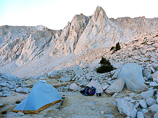
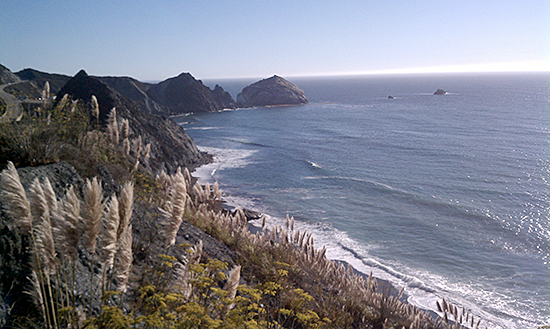
We were almost at base camp when we met the day hikers returning. They had not summited. Wisely they had set a turn around time if they were to be back to their vehicle before dark. We found a snow-free spot for our base camp at 10,700 feet and hit the sack just after sunset.
We were packed and ready for the climb the next morning. During the night I experienced a painful charley horse in my left thigh. Bright and early the next morning we set off for the climb. At the base of the couloir I decided to turn around. My leg was hurting, and I had very low energy. We returned to camp and we spent much of the rest of the day resting and sleeping. I spent a lot of time over the next few days wrestling with the decision. It’s all right to turn around. The difficult creek crossings had sapped my energy. I figured I could probably get up the peak, but was not sure I could get down. Time to turn around. Packing up the next morning I was not looking forward to crossing the creek again. It was clouding up; weather was moving in. The hike down was gnarly: steep snow in places, and lots of brush. We camped that night at a sandy spot at 9000 feet before we got to any of the crossings. When we got to the third crossing, we saw the water was up making the transition to the log a bit harder. We had taken a more direct route to the site of the log by clambering down a steep slope and thrashing through the willows. Others had traveled that route before us. Bears had left plenty of “bear sign.” I stumbled across a lost trove of extra batteries and a decaying plastic pill bottle of matches dropped by a hapless climber. Needless to say we removed these toxic materials from the wilderness. At the log we broke down the packs and ferried the contents in multiple trips. Richard perched on the log, and I stretched across the place where the log didn’t quite reach the bank and handed items to him. Between the third crossing and the second crossing the trail plunged steeply downward. We passed through a ghost forest of burned trunks from the 2007 fire.
We marveled at the flowering glory of the place. Treasures we had passed in the dark on our way up bobbed in the breeze. Entire hillsides of white lupine waved as we walked by. An uncommon Fritillary (Fritillaria pinetorum) heralded our safe return..
I was getting more tired and grumpy. “They need to maintain this trail,” I griped. And then I thought of the Fritillary. Maybe not. With more foot traffic, these beauties would be trampled. Perhaps we are the ones who need to stay away. The ever darkening sky caught our attention. As drops started to fall we took off our packs, placed our foam pads at the base of a multi-stemmed black oak tree and covered ourselves with one of our space blankets. After the thunder and rain stopped, we emerged from our shelter to an unusual upside down rainbow below us. When we found the place where we had crossed Oak Creek on the way up, we discovered it was too dangerous to cross there again. The water had risen several inches in five days. Before reaching this crossing, we found the upsteam “log” where the young men had crossed. Perhaps doable if one were 30 with a light pack. It was covered in rotten bark that looked like it might peel off if one stepped on it. It was broken in the middle and then slanted up sharply to the far bank. And it was located about 10 feet below the severely cut away creek bank. Our only recourse was to continue downsteam on the south side of the creek. Without even an unmaintained trail the going was rough. There were downed trees to climb over. We crossed a steep slope left from a landslide. As I plunge stepped on unstable landslide much like on a snow slope, I noticed a small newt inching its way upward. We wouldn’t find a crossing that evening. We set up camp at the base of a Jeffrey Pine and decided to deal with it in the morning. Paralleling the creek wasn’t easy. The creek was in a bed with steep banks and could not be viewed from our path. Next to the creek in most places were thickets of willows and patches of stinging nettle.
We hiked along looking in the direction of the creek for an opening or a more level spot that would be easier to ford. Richard spotted an area less brushy and more level. “Let’s check it out,” I suggested. “There’s a log!” I shouted. Yes, before us lying across the roaring creek was a big fat log bristling with branches, some rotting and some firm. We would have to test each branch carefully. And we were across. Only a mile from our truck. We wouldn’t have to walk all the way to Independence or to where the lovely creek enters the pipe which carry its water to Los Angeles. We were home free. Open Letter to California State ParksMarch, 2019
I am writing today to bring an issue to your attention. I have been camping and day hiking at Limekiln State Park since about 2001. I won’t bore you with the usual "it was so great way back when," but on my last weekend camping trip on January 26 I saw way more day hikers than ever before. The concession company staff running the park were packing in every car that showed up. I had one of the beach sites, and the day use cars were being packed into that area as well as every square inch between the entrance station and the redwood campsites bathroom. Being on the Limekiln Falls Trail that Saturday afternoon was more like being in an Epcot Center Disney World exhibit than the natural habitat. I know Cal Parks has to balance conservation with visitor access, but I think the concession company contracted to run Limekiln is solely interested in collecting the entrance fees, and not the condition of this rare and unique place. I know this wouldn’t be happening if Cal Parks Rangers were on site. I accept the financial reality of having concessioners manage the parks, but I implore you to exercise more oversight to ensure the quality of these naturals wonders and restrict the number of people in the park at any one time, even if this means a reservation system for day use. Attached is a photo (or rather a composite of several photos taken over 30 minutes) illustrating what it was like that day on the Limekiln Falls Trail. Thank you for your consideration of this matter. —Steve Zmak Ventana Chapter Files Amicus Brief in California Supreme Court
|
|||||||||||||||||||||||||||||||||||||||||||||||||||||||||
|
|
|
|
|
|
|
|
|
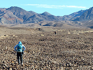
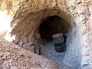
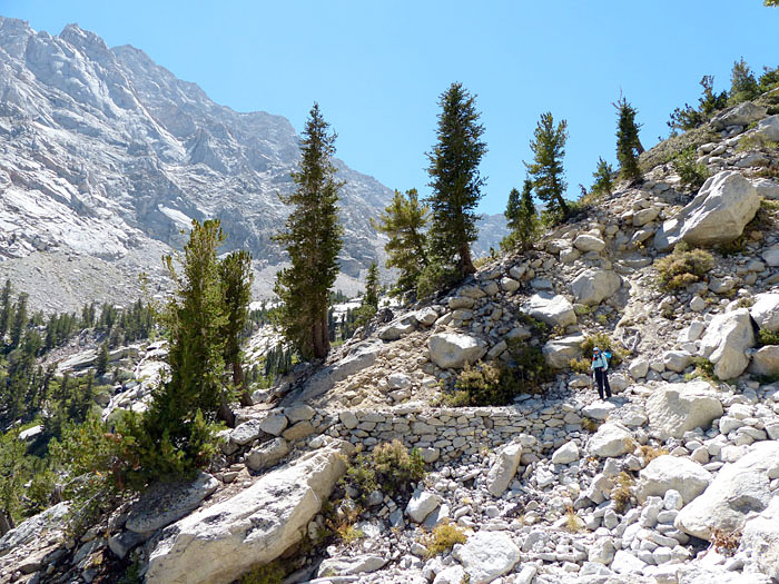
We started hiking up a wash, then on an old mining road which had a spur leading to an adit which we found interesting.
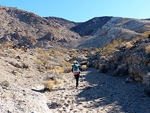
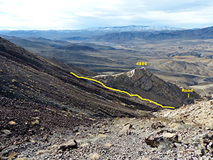
We backtracked to the road and then hiked off trail up a steep slope and eventually reached an old miners trail which led to a saddle a few hundred feet below the summit.
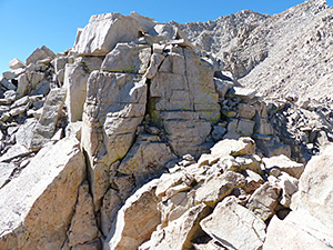
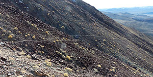 The old miners trail could not be seen from below. We took this shot on the way down.
(Click on photo for larger image.)
As we approached the summit, again off trail, we heard a low rumble. Then perhaps two thousand feet below us, we saw several very-slow-moving large planes flying south down Panamint Valley. These were not the roaring fighter planes we have seen many times in Saline Valley and Panamint Valley. Were they bombers? transport planes? Were they practicing flying so low to avoid radar detection? Let me know if you know the answer.
From the summit we could see snowcapped Telescope Peak and to the west the Sierras. Glorious.
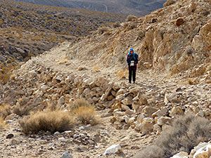
On the way down we stayed on the unmaintained trail a bit longer until we could descend to the abandoned road by skirting the east side of hill 4806.
The jaunt took us about 6 hours. Time for a hotel and hot shower.
 Sierra Club supports clean, renewable energy sources as a means to address climate change and green house gases which severely threaten our planet.
October, 2018
Ventana Chapter members have been inquiring about Monterey Bay Community Power, the electric generation service which began operations in Monterey, Santa Cruz and San Benito Counties earlier this year and was supported by Sierra Club California. This is a description of the program drafted for us by the provider.Monterey Bay Community Power Helps Drive California's Climate Action Successes
Following in the footsteps of 19 other locally controlled, not-for-profit public organizations across California known as Community Choice Energy (CCE) agencies or Community Choice Aggregators (CCAs), Monterey Bay Community Power (MBCP) began service In March and July of this year to non-residential and residential customers respectively, providing carbon-free electricity to businesses and residents in Monterey, San Benito and Santa Cruz counties. MBCP's promise? Cleaner energy at a lower cost.
With the support of local governments in all three counties and 16 cities within tri-county, MBCP is putting the Monterey Bay region on a path defined by three guiding principles; local control, clean energy and economic vitality. Many cities and counties in the Monterey Bay region see MBCP as one of the key drivers to meet their climate action goals and support additional efforts to reduce greenhouse gas emissions.
As a public agency, MBCP does business in a fundamentally different manner than investor-owned utilities (IOUs) like PG&E. With oversight by a Policy Board and an Operations Board, both of which are comprised of the region's elected officials and city managers, MBCP provides transparency and local accountability where IOUs do not, from board meetings that are open to the public all the way down to important details on customers' electricity bills. MBCP also formed a Community Advisory Council earlier this year to assure that the agency is addressing the needs of all stakeholders in our diverse region.
Like all other CCAs, MBCP is committed to procuring the electricity needed for its service area through clean-energy sources. Unique to MBCP is the commitment to utilize only carbon-free sources from wind, solar and hydroelectric – and no nuclear. In collaboration with the Monterey Bay Aquarium, MBCP also fast-tracked a premium service offering, MBprime, for customers who prefer 100% renewable energy generated exclusively from wind and solar. MBprime is available to all MBCP customers for an added cost of $.01 per kilowatt hour. MBCP also outfits customers with convenient means to pass their own savings onto the community through two different rebate options known as MBgreen+ and MBshare.
The third defining principle for MBCP is reinvestment in the local community. As opposed to the IOU model where profits are passed on to investors and shareholders, MBCP keeps surplus revenues local through cost-savings and by reinvesting in local programs that further reduce greenhouse gas emissions. MBCP's three pillars for reducing greenhouse gases emissions are focused on transportation electrification, building electrification and distributed energy resources.
Today, CCAs are serving more than 8 million customers in more than 160 communities across California that are building a better future through innovation, collaboration and bringing clean energy home. Combined, the CCA community is helping to drive California's climate action success by reaching renewable energy targets more than a decade ahead of time, making long-term contract commitments that support new in-state renewable energy facilities, and reinvesting millions of dollars in innovative community energy programs and job creation. To learn more about MBCP, visit mbcommunitypower.org, email or call the customer support number: 888-909-6227.
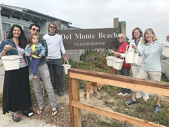 Colleen Devlin, (far right in photo) with neighbors in the Del Monte Beach neighborhood with some of the 27 counter top compost bins donated to their pilot composting program by Ventana Chapter Sierra Club.
October, 2018
Ventana Chapter Executive Committee member, Carolyn Hinman coordinated with Colleen Devlin in a local Monterey neighborhood to create a composting program with the assistance of Monterey Regional Waste Management District. We donated 27 counter top bins to the residents and now the neighbors are talking it up and building momentum to fill a large centrally located commercial compost bin each week. Del Monte Beach is the first neighborhood in Monterey to pilot composting services into a neighborhood, using the existing service provided to commercial businesses & restaurants. They have just started their second year of service, and currently have 10 neighbors each supporting a month of the cost ($33.90) so they can make it available for everyone to give it a try.
The community outreach manager at Monterey Regional Waste Management District is Jeff Lindenthal. He has also set up composting services at a couple of the local farmers markets so residents can have a place to drop off their kitchen compost. If Sierra Club members want to try this in their neighborhoods, Jeff would be happy to hear from you. His contact information is: and his phone number is 831-264-6390
.
 The east buttress of Mount Irvine is impressive.
(Click on photo for larger image.)
by Debbie Bulger
September, 2018
Mount Irvine, named after Andrew Irvine who died attempting Everest in 1924, rises impressively above Meysan Lake near Mount Whitney. Richard Stover and I attempted to climb the northeast ridge.
From the get-go this trip had a lot of glitches. The first were the fires that closed Highways 89 and 395 north of Bridgeport, our planned driving route. Next, we were unable to secure a permit for our planned ascent of Mount Goode; Mount Irvine was our backup, and I had not researched the route adequately. After all, it looked easy on the map.
 Meysan Lake Trail. Lone Pine Peak is seen to the left in this shot of the Meysan Lake Trail.
The 3,600' gain to Meysan Lake proved more tiring than I recalled, perhaps since I hadn’t been up there since 2008 and was 10 years older now. The scenery as usual was spectacular.
Partway up the trail we spotted Spotted Tussock Moth caterpillars, fluffy creatures which seem to be a cross between a small terrier and a pushmepullme. One has difficulty discerning the front from the back.
 Which is the front and which is the back?
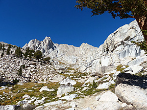
 How did I ever climb this chute when it was filled with snow in 2003 when I climbed Mount Mallory? It is 2000 feet from the lake to the skyline.
 Once in camp I marveled at Meysan Lake set in a deep bowl at 11,500'. How in the world had I scrambled up the narrow 2000-foot chute across the lake 15 years previously when it was filled with snow on my way to Mallory?
We set out the next morning at 7 a.m. to first gain the saddle to our north, then do the ridge. I was moving slowly, likely needing another day to acclimate, and had a scratchy throat. At the first gendarme I decided I would rather use another route. The rock was loose, and the narrow "bridge" to the easier slope was more than we wanted to handle that day. We bailed.
Back at camp we found a marmot had gotten into our dishes which we had hung in our tent bag on a too-short Foxtail pine. The tent bag was shredded and the dishes covered with marmot slobber. We boiled the spoons before making soup for supper in the pan.
That night the temperature dropped, and the wind picked up. We were camped on sand, and whenever a gust came, sand sprayed over us. In the morning everything inside the tent looked like a night in the Sahara.
The trek down to the car provided us with splashes of fall color and picturesque looks back at what might have been an easier route 20 years earlier.
 This is where we decided to turn back. This is where we decided to turn back.(Click on photo for larger image.) |
 Hiking back down the trail we could look back and see the peak left of center and the ridgeline to the right which we had attempted. We got to the top of the first point on the right. Hiking back down the trail we could look back and see the peak left of center and the ridgeline to the right which we had attempted. We got to the top of the first point on the right.(Click on photo for larger image.) |
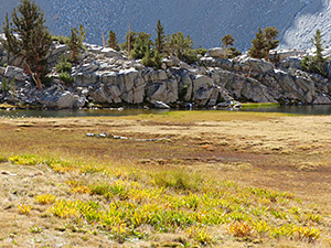 At Grass Lake the shooting star leaves gave splashes of yellow to the scene. At Grass Lake the shooting star leaves gave splashes of yellow to the scene.(Click on photo for larger image.) |
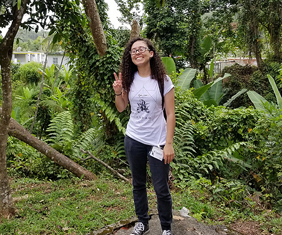 Ventana Chapter sponsored member Kianni Ledezma in Puerto Rico for Sierra Club SPROG program.
by Kianni Ledezma
July 30, 2018
As I waited to meet the other two students who were going to be flying with me to attend SPROG in Puerto Rico, I could already feel the importance of this trip and this leadership training. I realized that SPROG Puerto Rico 2018 was one of those experiences that was only going to come once in a lifetime. And I was right.
SPROG was an intense week long training that taught me so many new skills and tools to use for my future social and environmental justice campaigns and projects. SPROG took me to a place called Casa Pueblo who shared their important story of resilience and social work. Their history taught me the importance of not giving up because if you believe in something and you know it will make a difference then you have to keep going and treading along until you reach your goals.
Each session that took place at SPROG taught me something different. SPROG showed me the difference between mission and vision. The difference between a strategy and a tactic. SPROG also showed me the importance of taking action and not waiting for someone else to do it because you have to stand up for what you think is right.
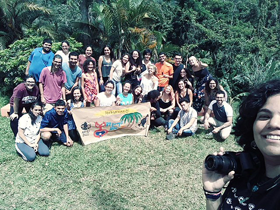 Sierra Club SPROG program students in Puerto Rico in July.
SPROG also let me experience the culture, the food, and the different stories of the people of Puerto Rico. Hearing the conversations about the grass root actions taking place in Puerto Rico by students and citizens filled me with hope for the future of this planet. It made me realize that there are so many people out there like me who are trying to make a change. It inspired me to keep trying to call for action in my community.
All this topped with being in such a beautiful place such as Puerto Rico was an incredible experience, one I will never forget. I would like to thank the Sierra Club and the Ventana Chapter for sponsoring me to attend this amazing training.
More about the Club's Summer Program.
July 2018
This month Ventana Chapter is sending seven local college students from California State University at Monterey Bay to Puerto Rico and Los Angeles to attend weeklong workshops to build leadership and activist skills. Living in a summer camp/nature focused setting, participants from 18-28 years of age, come from a wide variety of backgrounds and share excitement to learn about organizing and a deep interest in environmental issues.
This program, called SPROG is run by the Sierra Student Coalition and has been operating for 30 years providing grassroots leadership training for young people. Some of the curriculum offered includes:
• Campaign planning: identifying campaign goals and targets, writing strategy statements, crafting tactics, using a campaign matrix
• Leadership development: building effective bases and coalitions, working with communities, demonstrating self-care and personal productivity, facilitating group discussions
• Anti-Oppression: identifying and confronting oppression, running campaigns for justice, emphasizing anti-oppression as central to all environmental organizing
• Media: creating outreach material, interacting with reporters, writing Op-Eds, holding press conferences
We look forward to welcoming our students back to Monterey and having them share their experiences and new skills with our membership through the Chapter website and Face book page.
by Debbie Bulger
June 2018
This mountain in the Ansel Adams Wilderness east of Fresno is not the only peak with this name in California. I have climbed two other peaks named Silver, and I know of at least one more. One is near Ebbetts Pass and the other is in Desolation Wilderness near Lake Tahoe. The one I have yet to climb is in the Mojave National Preserve.
Richard Stover and I left Santa Cruz at 7:30 in the morning and started hiking from the Vermillion Resort on Lake Thomas Edison at 4:30 that afternoon. The advantage of hiking from a Westside trailhead is that one has time to drive to the trailhead, pick up a permit, stop for lunch and get a few miles down the trail before setting up camp.
The Onion Spring trailhead apparently sees little traffic, and the Onion Spring Campground marked on the topo map is long abandoned. Flowers were blooming and mosquitoes abundant and persistent.
On our first full day we were passed by a solo hiker from the Czech Republic on his way to Mammoth Lakes who wanted a change from the John Muir Trail, to the east. To our surprise he passed us again going back to Vermillion the next day. The trail was unmaintained, and the going slow. Ondrej was concerned he might not be able to make his flight back to Europe should anything happen to him on this nebulous trail.
Sierra wallflowers dotted the way and Arnica and various Delphiniums provided yellow and blue and pink splashes of color. Entire hillsides were covered with dwarf lupine once we emerged from the trees.
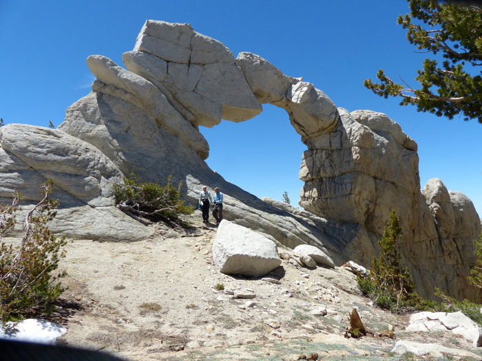 Arch Rock. Photographer: Richard Stover.
Click on image to see larger size.
Day two was magnificent as we stopped to enjoy Arch Rock, a stunning formation that rivals arches in national parks. I later learned there are two Arch Rocks in Sierra National Forest, one not nearly so spectacular and only a short walk from a road and this one which is about 7 miles from a trailhead. To complicate matters even further, this lithic marvel is not where it is indicated on the topo map. If you are looking for it, try the next saddle north of the high saddle with the peculiar survey marker “Lead.”
From both saddles we had an expansive view to the north where the high peaks of Ritter and Banner dominated the vista. We saw a thin plume of smoke from a wildfire just starting.
We descended to Frog Lake and marveled at the work that had gone into the trail construction. There were rock walls, water bars, remains of a stock fence, and even stairs. This trail must have seen a lot of use in the 1960s. There were old blazes on giant Lodgepole pines. I don’t know why this trail is little used and not maintained today. Perhaps the nearby John Muir Trail is what most people prefer.
As we proceeded the trail became increasingly difficult to follow in places. It is a bit of a puzzle and exactly the navigation challenge I enjoy. One bomb-proof indication of an old trail is a cut log.
To our delight a bald eagle buzzed us as we crossed the marsh south of Coyote Lake. Unfortunately we weren’t quick enough with the camera to get a good photo. To our dismay we found another lost balloon.
That evening we camped above Coyote Lake which lived up to its name. Shortly after retiring we had a short serenade from a high-pitched canine. It was the only time we heard a coyote on the trip.
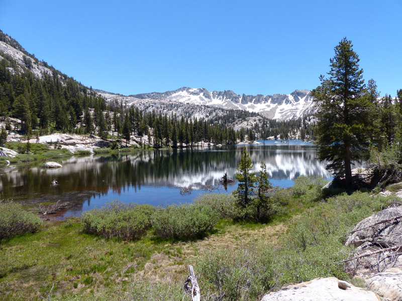 Beautiful Rainbow Lake. Photographer: Richard Stover.
Click on image to see larger size.
By lunch the next day we had passed Baby Lake and reached our base camp at Rainbow Lake. We had taken the long way, but that was the point. We spent the afternoon in heaven: rinsing out dusty clothes and bathing in the mid-day respite from aggressive mosquitoes. Camp was on a peninsula high above the lake on both sides. There was light grey granite all around except for a huge dark glacial erratic under which we stowed our bear cans.
We climbed Silver the next day. We ascended the Penstemon-sprinkled west ridge, a fun class 2-3 scramble which we enjoyed. On the way up we encountered a Green Pine Chafer, an iridescent beetle that eats pine needles. Lest any of you think I’m a super grandma, I want you to know the climb took 14 hours. I told you we were slow. I slept til noon the next day. I was wiped.
From the summit we could see that the little puff of smoke we had seen two days before had exploded into a huge cloud reaching high above us as we stood at nearly 12,000 feet! The west wind was blowing the smoke towards Mammoth Lakes. But what if the wind should change?
We spent more than an hour on top taking photos and perusing the register. In addition to the traditional benchmark there was an odd button-sized marker clearly marked USGS in the center of an incised X on the rock. Then we slid down the unstable northwest face. Take one step and the whole mountain moves. Much less fun than going up.
Back at camp supper consisted of celebratory Newman’s O’s. Then another layover day to splash in the lake and rinse out our clothes.
We hiked back to Vermillion in record time since we were concerned that the wind might change and we could be caught in the smoke.

 Volunteers from the community help install new fixtures and equipment funded by the Chapter at Goodwill Gardens in Marina. (Photograph:Reid Norris).
April 2018
Earlier this year we provided Everyone’s Harvest with a $2,000 grant to purchase equipment and supplies for the Goodwill Garden in Marina, a one-acre green space where people can come together and experience growing their own produce. This program provides free and accessible community gardens to adults with disabilities and other marginalized people in order to provide them with fresh organic fruits and vegetables.
Utilizing our funds, Everyone’s Harvest recently had a project day shown in these photos and invited the community to install improvements to make the garden beds more sustainable and eco-conscious. We are excited to help with this valuable service to provide healthy local produce and support a fair and environmentally friendly food system.
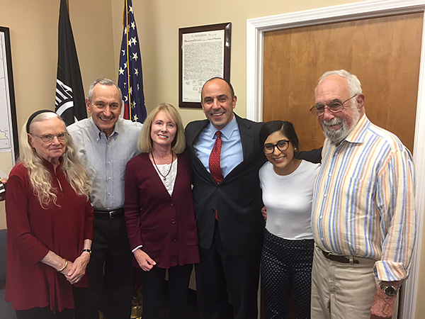
Ventana Chapter Executive Committee members met with Congressman Jimmy Panetta to discuss his commitment to human rights and protection of the environment.
From left to right: Dale Agron, Rich Fox, Rita Dalessio, Congressman Panetta, Alexandra Payan and Neil Agron.
By Carolyn Hinman
April 2018
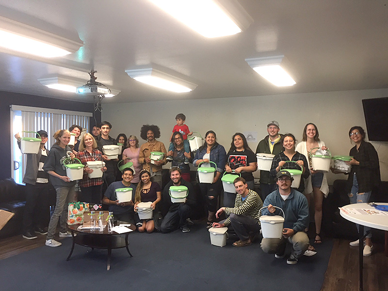
Americans waste 40% of their food, and throw a lot of that food waste in the trash. All of that food breaking down in the landfill releases greenhouse gases that contribute to climate change. Cal State Monterey Bay is taking steps to reduce and divert their food waste to reduce their carbon footprint.
The Ventana Chapter of the Sierra Club sponsored the purchase of 300 Sure-Close countertop food waste containers for CSUMB's East Campus residential community to make it easier for them to keep their kitchen scraps out of the trash. On March 29th, over 70 East Campus residents took containers home with them after a special event called Food is a Terrible Thing to Waste. Attendees ate pizza provided by Green Waste Recovery, learned a little bit about food waste, made a take-home bean and lentil soup mix, and mingled with other environmentally minded people.
We can't wait to see how much food waste East Campus can keep out of landfills and hope that food waste diversion will make its way to the rest of the CSUMB campus.
 Carolyn Hinman, second from left, distributes free countertop compost bins from Ventana Chapter to students in CSUMB East Campus housing.
March 2018
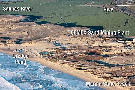
Last July, the California Coastal Commission voted to issue a Cease and Desist Order for the CEMEX Lapis plant in Marina. Since then, the sand mining operation is winding down its activities and expects to close completely in a few years. This will leave the way for Monterey Peninsula Regional Park District and State Parks to convert the site to protected habitat for rare and endangered species and allow welcomed new coastal access for the public in Monterey County.
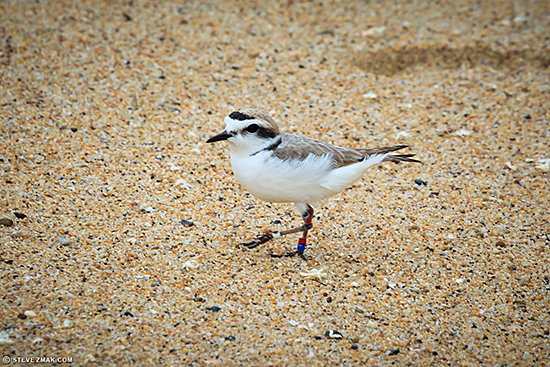
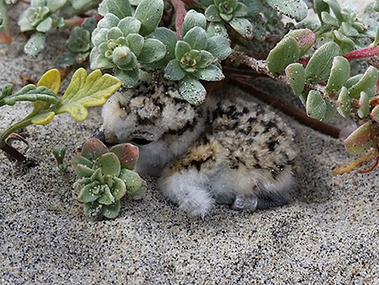
Local wildlife photographer Steve Zmak recently set up his extraordinary camera equipment to capture photos of three endangered Western snowy plovers inhabiting a site near the plant. The nesting period has just begun for these birds and will continue through September.
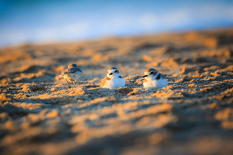 Three Western snowy plovers sighted near CEMEX plant in sand dunes in Marina. (Photographer: Steve Zmak).
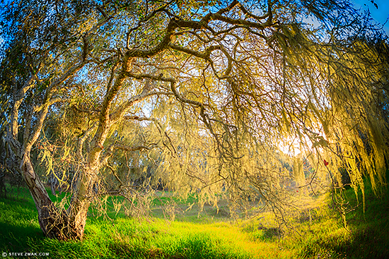 Beautiful heritage oaks and woodlands are under threat from proposed Eastside Parkway on Fort Ord. (Photograph: Steve Zmak).
March 2018
Ventana Chapter has been following development at the former army base at Fort Ord since the 1980's. We sued on the original EIR for the Base Reuse Plan and achieved a settlement agreement that curtailed new development. A major focus for protection were the large tracks of oak woodland habitat and rare old growth heritage oaks.
We have been working ever since to protect this unique plant community. The latest threat to these oaks is a proposed Eastside Parkway. This roadway would be intended to be a Southwest-Northeast arterial component of the Fort Ord transportation network near Seaside and Marina. Much of the acreage set aside for this project consists of mature oak woodlands which we have previously committed to preserve with a formal Habitat Protection Plan.
The Fort Ord Reuse Authority (FORA) has announced that the official environmental review process will begin in May with the distribution of the Notice of Preparation (NOP) for a 30-day review period. The process is expected to take until August 2019. The Chapter has announced opposition to this roadway consistent with priorities from our National Sierra Club.
National Sierra Club has consistently held policies which discourage road building as a cause of sprawl, congestion and other urban woes. Building new roads and increasing capacity on existing roads brings "induced" traffic - essentially "if you build it, they will come." Motorists will make longer trips, increase miles traveled, and new roads will encourage more sprawl development. In fact, only three years after new roadways open, traffic fills road capacity between 50 and 100 percent. Clearly, congestion is not something we can build ourselves out of with more road construction; it actually perpetuates traffic problems.
 From left to right: Ventana Chapter Executive Committee member Carolyn Hinman, Everyone’s Harvest Volunteer Chrystal Andon and Everyone’s Harvest Executive Director Reid Norris.
December 2017
This month the Chapter donated $2000 to Everyone’s Harvest Goodwill Community Garden Project in Marina. This unique program currently uses 80 raised beds on one and a half acres close to the ocean. Surrounded by native and drought-tolerant landscaping, it includes composting systems, a fog catcher and a hügelculture display. This display shows a no-dig raised bed using rotting wood, compost, manure and other nutriments that helps to hold water and raise heat for a longer growing season.
Everyone’s Harvest, in partnership with five other nonprofits prepare the beds and provide seedlings, plants and infrastructure to produce over 1,000 pounds of fresh and healthy fruits and vegetables grown and consumed by more than fifty clients.
The work is important because not only is the garden a place for the clients to grow healthy food, it is an opportunity for them to participate in horticultural therapy. This is a place where adults with developmental disabilities and veterans addressing trauma can build physical, emotional and spiritual wellbeing while growing their own food in a community garden.
 Goodwill Garden in Marina showing some of the 80 raised beds growing fresh organic produce for the community.
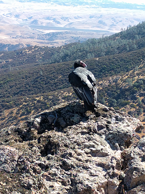
Chapter Hike leader Stanley Dudek took this photo from North Chalone Peak in October. This California condor's tag says 89 but it is listed as 589. It's a male that was released from Pinnacles in June 2011. It mated with 569, a female released from Big Sur in 2012. Their first offspring hatched successfully last June and received its tag (878) and transmitter early in October.
October 2017
Congratulations to Senator Bill Monning and Assemblymember Mark Stone for achieving 100% rating from Sierra Club California for their votes on environmental issues in the Legislature.
This an extraordinary record for our Central Coast legislators as only 10 Senators out of 40 and 13 Assemblymembers out of 80 were awarded this distinction.
To prepare the scorecard, Sierra Club California staff selected 12 bills to score in each house. The bills represent a cross-section of environmental and environmental justice issues and were among the top priority California legislation the Sierra Club’s staff and volunteers engaged in this year.
How each legislator voted on each bill was noted and a score was calculated by dividing the number of times the legislator voted with the
Club’s recommendation by the total number of bills for which the legislator was present to cast a vote.
Click here to see all results: http://www.sierraclub.org/sites/www.sierraclub.org/files/sce/sierra-club-california/PDFs/Final_Sierra_Club_CA_2017_Score_Card.pdf

September 2017
College campuses and their student populations are associated with youth, growth, parties, and out-of-the-box thinking. College students create and follow pop culture, influence political decisions, and champion social justice movements. Innovative thinkers like these also have their fingers on the pulse of the cutting edge of sustainability and conservation efforts. On August 22, 2017, the Sierra Club's magazine Sierra recognized Cal State Monterey Bay (CSUMB) as one of the nation's "Cool Schools." This year has been a tumultuous one for the US as Donald Trump pulled America out the Paris Climate Agreement, cut funding for scientific research on climate change, and vowed to revive the flagging and destructive coal industry. The schools on Sierra's list have committed to continue making strides toward sustainability and reduction of carbon emissions, and this year 239 colleges and universities submitted applications for the "Cool School" distinction. CSUMB was ranked number 152, and joined eight other CSU campuses in receiving the distinction.
Lacey Raak is the Director of Sustainability at CSUMB. For the past two years she has been working to increase the impact of the school's sustainability efforts. She says CSUMB is doing everything it should to keep up with the Jones' of the sustainability revolution. She hopes to see the university take a higher place in the ranking in upcoming years. "I think there are strategic actions that can be taken regarding waste specifically," says Raak. "It's so much deeper than recycling." Lacey believes that a deeper understanding of sustainability by a broader group of people is necessary for lasting change to take place... [more]
August 2017
The City of Seaside is in the process of drafting a new General Plan (Seaside 2040 Plan). This effort is expected to take about 2 ½ years and began in 2016. The City will include environmental review in accordance with the California Environmental Quality Act (CEQA) and adopt new development regulations including zoning and subdivision provisions.
In response to the City’s Notice of Preparation (NOP) Ventana Chapter has submitted comments voicing our concerns for open space and preservation of viewsheds and the availability of a sustainable water supply. Attached is a copy of our letter.
 Humpback whale breaching in Monterey Bay at Sand City in July.
August 2017
The Trump administration’s recent decision to direct the Secretary of Commerce to review the federally protected status of National Marine Sanctuaries is a dangerous and unprecedented move against our valuable oceans and coastlines. Locally, the Monterey Bay National Marine Sanctuary provides an economic engine, environmental protection for marine mammals and other sea life, research and tourism.
This decision could weaken protections for 11 National Marine Sanctuaries and monuments designated and expanded since April 28, 2007 including the Davidson Seamount in Monterey Bay. It is Trump’s blatant give-away to the fossil fuel companies to provide them with resource exploitation, including off shore oil and gas drilling.
Sanctuary status prohibits oil and gas exploration and drilling, establishes more stringent protections against pollution and bans disturbance to the seabed. It also stimulates partnerships with local governments to launch programs to protect and enhance marine resources and promote scientific research and education.
What can you do? Write letters and ask your friends and family to do so too. On July 26, the National Oceanic and Atmospheric Administration (NOAA) announced it would reopen the comment period until August 14, on Trump’s Executive Order 13795. Go to this link and let our government know you do not want oil and gas drilling in our oceans: https://www.regulations.gov/comment?D=NOAA-NOS-2017-0066-37125
July 2017
 The California Coastal Commission and CEMEX have come to an agreement to close down the sand mining operation over the next six years. (Photo: Steve Zmak).
On July 12, the California Coastal Commission voted unanimously to approve a Cease and Desist Order (CDO) for the CEMEX Lapis plant in Marina. This is the last coastal sand mining operation in the United States. The CCC agreement will halt sand mining in three years and close the business in six. Ventana Chapter has been following studies on the erosion of the shoreline around CEMEX since 2008. The shoreline from Monterey to the Salinas River is currently eroding at about 4 feet per year as a result of mining activity from this 104-acre plant site. This sand extraction and dredging operation is the largest human contributing factor to erosion on the California coastline.
The CCC has been looking into CEMEX for possible violations of the Coastal Act for the last few years. In March, 2016 the CCC threatened to issue the CDO over the violations and the two parties have been in negotiations ever since. On June 27, Marina announced a series of agreements had been reached with CEMEX and the three entities pursuing varying legal remedies.
Also at the meeting, the CCC granted approval to the application by State Parks for building a camping facility on Fort Ord Dunes State Park despite concern from speakers about possible contamination of the site due to lead bullets left over from Fort Ord's many years as an army training facility.
By Steve Zmak
May 2017
 (Photographer: Steve Zmak).
Whenever I'm walking one of the southern Monterey Bay beaches, I'm always on the lookout for the rare and elusive Western Snowy Plover. The first time I was able to record them was 3 years ago in Sand City on the site for the contested Ghandour Resort—I found 3 there nesting, and you've probably seen those photos here in the Chapter blog, Chapter mailings or MC Weekly articles on the subject. Snowy Plovers are often confused with the much more abundant Sanderling that runs in flocks up and down the water line. I thought that was what I was photographing again at Marina State Beach about a half mile south of the Beach Road parking lot on April 16, 2017. I was thrilled when I got home and could view them on my big display, and could see the ID tags around its legs distinguishing it as a threatened and endangered species. Although the Western Snowy Plover's habitat stretches along the entire U.S. west coast, most of it has been disturbed by one development project after another. It's not just the development footprint that runs the little birds off their nesting grounds. It's all the people and dogs drawn to once wild beaches that the developments sit at the epicenter of. Although Marina State Beach has strict leash laws, fenced habitat restoration areas, and a no drone fly zone during the March to September breeding season, it is rare to see these regulations followed by local beachgoers or out-of-town visitors. In reality and practice, it seems like we've already accepted this bird's extinction. The Ventana Chapter's ongoing campaign to block coastal developments like the Ghandour Resort in Sand City may be one of the last battles for the Western Snowy Plover's survival.
May 2017
This week, Congressman Jimmy Panetta signed on as a co-sponsor to HR 502 to provide robust funding for the Land and Water Conservation Fund (LWCF) in fiscal year (FY) 2018. Mr. Panetta serves on the House Natural Resources Committee so now every Democrat on the Committee supports this priority bill for Sierra Club.
Since its creation 50 years ago, the LWCF has helped to ensure the permanent protection, recreational access, and maintenance of critical lands in our national and community forests, recreation areas, parks, wildlife refuges, Civil War battlefields, and historic sites. Equally important, it has provided matching funds to support countless state park and recreation projects in thousands of communities in every state in the nation. The Forest Legacy Program (FLP) assists states in conserving working forestlands that are threatened by conversion to non-forest uses.
In every state, LWCF and FLP funds have ensured that all Americans reap the benefits of access to outdoor recreation, unique historic sites, clean water, and protected wildlife. Over the past 20 years, FLP has prevented the loss of almost two million acres of forestland in 42 states and leveraged an equal amount of state, local, and private funding for every federal dollar spent. Since its creation, the LWCF program has conserved more than five million acres of parks, recreation, forests, and other lands through the federal program and more than 2.6 million acres in communities throughout every state in the nation.
Locally, this funding has been used to purchase additional parcels for Pinnacles National Park and for the 1200 acre Brazil Ranch managed by Los Padres National Forest on the Big Sur coast.
April 2017
On April 6, the Center for Biological Diversity (CBD) and Sierra Club submitted nearly 100 pages of comments on the Draft Resource Management Plan Amendment/Draft Environmental Impact Statement ("RMP"/"DEIS") for the Bureau of Land Management ("BLM") Central Coast Field Office in Hollister. The Planning Area consists of about 6.8 million acres of public land which includes about 793,000 acres of Federal mineral estate in Fresno, Kings, Monterey and San Benito counties managed by the Central Coast Field Office. Of these 793,000 acres of Federal mineral estate, 368,800 acres are deemed to be "high oil and gas occurrence potential areas."
Our comments point out that oil and gas exploration involves highly controversial and severely harmful extraction methods, including horizontal drilling and hydraulic fracturing (or "fracking"). Extraction and burning of fossil fuels worsens the climate crisis; endangers water, air, wildlife, public health, and local communities; and further undermines the protection of our public lands. Because new fossil fuel leasing within the Planning Area will contribute to worsening the climate crisis, we believe that the vast majority of all proven fossil fuels must be kept in the ground.
Furthermore, opening up new areas to oil and gas exploration and unlocking new sources of greenhouse gas pollution would only fuel greater warming and contravenes the Federal Lands Policy and Management Act of 1976 that mandates that BLM manage the public lands "without permanent impairment of the productivity of the land and the quality of the environment."
(To read the entire 99-page letter, click here).
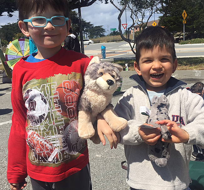
Sierra Club Ventana Chapter was a proud sponsor for Earth Day in Marina on April 8. Despite some wind and rain, there was a great crowd and wonderful food. Here is a photo of two lucky brothers that won stuffed animals we donated to the raffle. |
 |
March 2017
Sierra Club Southern California Forests Committee just released their plans to Club activists for increasing wilderness areas in California in 2017. The Southern California Forests Team's goal is the protection and restoration of the four southern California National Forests, which stretch from Big Sur to the Mexican border in San Diego County and which attract seven million visitors a year. From north to south, the forests are the Los Padres, Angeles, San Bernardino, and Cleveland National Forests.
Bottcher's Gap in Los Padres National Forest within Ventana Chapter boundaries will be the starting point for a designated Condor National Recreation Trail as part of a proposed Central Coast Protection Act. This trail will provide a continual hiking trail corridor spanning the entire length of the Los Padres National Forest south along the coastal mountains of Central California. The trail will traverse a diversity of geography and communities through the southern and northern sections of the Los Padres National Forest and protect wild and scenic rivers.
Other goals of the Southern Forest Committee include:
1) Work with the Desert Committee on Senator Dianne Feinstein's California Desert Protection Act of 2017. Additional wilderness and wild and scenic rivers will be added to the San Bernardino National Forest by passage of this legislation.
2) Support the newly designated San Gabriel Mountains National Monument in the Angeles and western San Bernardino National Forests with committee expertise on specific wilderness areas and rivers.
3) Support protection of the Santa Ana Mountains.
4) Monitor all planning activities on the four Southern California National Forests. This includes reviewing all NEPA documents on these forests and sending out action alerts to our members to get the maximum amount of environmentally effective input.
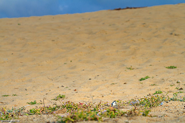 Western snowy plover nesting in undisturbed habitat currently on the site of the proposed Monterey Bay Shores Resort. (Photographer: Steve Zmak).
February 2017
The Chapter continues to oppose development in 39 acres of beachfront dune habitat for federally protected western snowy plover. In addition to Dr. Peter Baye, coastal ecologist and Dr. Scott Cashen, wildlife biologist and foremost authority on western snowy plover, the Chapter has now retained avian ecologist Michael Morrison to comment on the Project developer, Ed Ghandour’s Habitat Protection Plan (HPP). The Project calls for a 1.34 million foot mixed-use resort in Sand City which entails approximately 680,000 cubic yards of grading, utility extensions and infrastructure, and related development (e.g., roads, parking lots, signs, and lights). The chief concern is the long-term presence of breeding western snowy plover (Charadrius nivosus nivosus) on this site.
Dr. Michael Morrison, relying on nearly 40 years of work in avian ecology and wildlife management, reviewed the HPP and associated appendices. While the stated goal of the HPP is to demonstrate the developer can construct the Project without modifying or degrading critical habitat for the plover to the level that it will kill or injure wildlife, Dr. Morrison’s concludes that this is not the case. In his January 25, 2017 letter, he sets out arguments that based on the size of the proposed project, and the subsequent amount and intensity of human activity, there is nothing that can be done to eliminate or even develop meaningful on-site mitigation in the Project area for snowy plovers. He bases his conclusions on the following critical facts:
Dr. Morrison concludes that the HPP and PMP are hopelessly vague with regard to all aspects of plover management. He states it is evident that the HPP and PMP will completely fail to reach the goal of retaining plovers in the Project area. Therefore, there is no doubt that “take” of the western snowy plover will occur associated with implementation and operation of the Project. (Attached is Dr. Morrison’s full letter and scientific references).• Snowy plovers react to human disturbance, even when the source of disturbance is a considerable distance away. Studies have shown that snowy plovers require a buffer zone free of human disturbance that extends at least 100 meters from the nest site. Plovers did not acclimate to, or successfully find refuge from, human and human-related disturbance; feeding rates also declined with increased human activity. The Project site is not large enough to install effective “nest protection zones” for snowy plovers.
• The HPP divides the Project site into multiple “habitat management areas”. There are two proposed areas for nesting comprising of about 10 acres. Human access to these areas will be developed including three beach access ways, a public vista point, and two private resort vista points. Thus, plovers will be confined to two management areas that will have substantial human visitation. Based on the known intolerance of plovers to human activity within a mean distance of 80 m (262 feet), and the known distribution of plovers across the Project site, no locations within designated management areas will allow for occupancy, let alone successful nesting, by plovers.
• The HPP includes a Predator Management Plan (PMP) which acknowledges that multiple species could be responsible for predation of plovers and their nests, yet provides no specific plans on how predator management might be implemented.
 Fort Ord Dunes State Park near California State University at Monterey Bay. (Photo: Carolyn Hinman).
January 2017
By Carolyn Hinman
2016 is a year many environmental activists can be proud to put down in the record books. President Obama ordered protections against drilling in parts of the Atlantic and Arctic Oceans, renewable energy is projected to outpace coal as the world's major source of electricity, and rates of greenhouse gas emissions are reported to be slowing worldwide. Here on the Central Coast, the highly contested Monterey Downs project was withdrawn by the developer, and the November 8th election brought about a statewide ban on plastic bags. It is exciting to see such progress unfolding, and emotions are running high as personal investments in these steps to intervene in the crash course upon which humans have set the planet seem to be paying off.
High on any environmentalist's list of concerns is what the incoming Trump Administration will mean for the future of our Country and the world. 2016 may have been a banner year for the green movement, but we are all watching in shock and horror as the president-elect appoints oil magnates and climate change deniers to his advisory cabinet. What does 2017 hold for the health of our planet? Trump has vowed to back out of the Paris Climate Agreement, to resuscitate the flagging coal industry, and to eviscerate the EPA.
Decades of hard-fought battles on the environmental front culminated in victories in 2016. Do we risk losing all of that progress now that profit-seeking special interests could be in charge? Although victories at Standing Rock over the Dakota Access Pipeline, worldwide regulations protecting our oceans, commitments by China and India to limit global warming to two degrees Celsius – all could be for naught at the bidding of this new Administration, I can't help but maintain a sliver of hope. We have come too far, and have pushed too hard to let it crumble around us. Out of adversity comes strength beyond measure, and if ever there was a time to band together and take a stand for truth and justice, it is now. Perhaps out of the new Administration's resistance to progress will grow a social and environmental justice movement the likes of which have not been seen in our lifetime. We must continue to speak up; we must refuse to accept this growing climate of hateful prejudice and targeted oppression. We must not become desensitized to the slowly boiling waters of tyranny, censorship, and willful ignorance. As we move into 2017, it is our responsibility to keep our eyes and our minds open to what is happening around us.
Our power is in our numbers and in our dedication to preserving this one precious planet upon which we live. Our power is in our truth, if we will only continue to speak it.
January 2017
On January 5, the Bureau of Land Management (BLM) released the Draft Resource Management Plan (RMP) Amendment and Draft Environmental Impact Statement (EIS) for oil and gas leasing and development in the BLM’s Central Coast Field Office, which includes Fresno, Kings, Monterey and San Benito counties for a 90-day public review and comment period.
In 2011, Sierra Club and Center for Biological Diversity filed a lawsuit challenging BLM oil and gas leases in Fresno and Monterey counties, arguing that BLM had failed to consider the possibility that these leases would be fracked, and the risks that would entail. We won in 2013, with the court agreeing that BLM had broken the law, with BLM taking a voluntary remand to correct its deficient environmental analysis. That process has been delayed, because BLM's first attempt at a re-do relied on BLM's nationwide fracking rule, which is tied up in a separate lawsuit (we're defending the rule).
Sierra Club is planning to submit comments by the close of the BLM comment period on April 6, 2017 which will be posted on the website.
December 2016
 Acres of prehistoric dunes threatened by resort development in Sand City. (Ventana Chapter file photo).
 The last months of 2016 brought good news on several fronts locally for the environment. November elections delivered victories from Monterey County voters to ban fracking (Measure Z), fund parkland on the Monterey Peninsula (Measure E) for the Monterey Peninsula Regional Park District and improve transportation routes (Measure X) with a focus on alternative transportation options including walking and biking. Ventana Chapter endorsed these initiatives and congratulates these campaigns for their powerful grass roots efforts at reaching the voters.
In December, the developer of a proposed massive development, Monterey Downs, planned for forested hills in the back county of Fort Ord that would have replaced 40,000 oak trees with over 1200 homes, commercial space and a horse racing facility unexpectedly withdrew his application from the City of Seaside. The project, introduced nearly six years ago, was opposed early on by environmentalists but as time went by, a majority of residents of Seaside and the surrounding communities complained about the lack of real jobs, the unsustainability of one-time construction starts and the negative impacts the project would bring to the region.
It is not certain, what, if any, future development will occur on these oak-studded former Fort Ord lands. To ensure protection, the Chapter is attending workshops and submitting comments for the Oak Woodlands Protection Plan as part of the planning process now taking place for incorporation into the Fort Ord Base Reuse Plan.
The Chapter will continue to focus on coastal habitat, water and wilderness issues in 2017. Our attorney, Larry Silver and several scientists are continuing to work hard to defeat the construction of two proposed resorts in coastal dunes in Sand City. Our legal efforts over the last 20 years have so far blocked development of the Monterey Bay Shores Resort on 39 acres of beachfront property. This is a priority issue for us as the site is an important nesting area for rare coastal populations of Western snowy plover as well as federally threatened Monterey spineflower and endangered Smith’s blue butterfly.
November 2016
The Chapter has submitted comments regarding a proposed Oak Woodland Protection Plan for the former Fort Ord lands. Listed here are 2 opportunities for the public to participate in workshops on this plan:
Oak Woodlands Community Meetings
Community meetings will be held to discuss Oak Woodland Policy and Programs in areas slated for development in Monterey County and City of Seaside former Fort Ord lands. Learn what they are envisioning for Coast Live Oak Woodland management. Add your voice to help shape policies and programs for this important resource. Light refreshments will be served. Board Members and/or Councilmembers may appear at the meetings, but not for the purposes of decision making.• City of Seaside: November 15 | 6-8pm, Seaside Community Center at Soper Field, 220 Coe Avenue, Seaside. For more information contact:
• Monterey County: November 19 | 10am-12pm, Trackview Pavilion at Laguna Seca Recreation Area, 1025 Monterey Hwy 68. For more information contact:
Cape San Martin on the South Big Sur Coast, a spectacular sight for users of day use areas and campsites scheduled for fee increases. (Photo: Rita Dalessio).
October 2016
The United States Forest Service (USFS) is proposing to privatize 52 recreation sites in the Los Padres National Forest, including the Big Sur coast, with little opportunity for public comment. USFS intends to issue a concession campground and recreation site Special Use Permit (SUP) to a private parks management firm to oversee and manage government-owned facilities. Many of the fees charged at these sites will increase significantly (some as much as 300%) with little or no increase in services or amenities, which will have a direct socioeconomic impact on all forest users. The plan – scheduled to be approved this month – would apply to popular campgrounds, day use areas, and some trailheads in Monterey, Santa Barbara, Ventura, and San Luis Obispo counties.
Monterey Ranger District properties affected would include Arroyo Seco Campground (CG), Arroyo Seco Day Use Area, Bottcher’s Gap CG, Kirk Creek CG, Nacimiento CG, Plaskett Creek CG, Ponderosa CG, Mill Creek Day Use Area, Sand Dollar Day Use Area, Willow Creek Day Use Area, and Pfeiffer Beach Day Use Area, Memorial CG, Escondido CG, White Oaks CG, and China Camp CG.
Several Sierra Club Central Coast Chapters are partnering with a variety of outdoor organizations including Los Padres ForestWatch to review and respond to the proposal. (See PDF letter here).
September 2016
By Mary Pendlay
All of us have been affected by the Soberanes and Chimney fires, either personally or as a neighbor. We’ve seen pictures, read the facts, and felt helpless, but there is a power in Nature to renew itself which we may not see at first. Very close to us, at the top of Jacks Peak in Monterey, stretching 1,096 feet high, is a flat meadow and part of the Skyline Trail which borders an open area filled with baby Monterey pine trees. Just a few more inches of rain last year, and four, six and eight inches of small, healthy, immature pines bask in the sun. Despite the terrible drought of five years, which has decreased the release of pollen, this hardy species is surviving and producing a new generation.
Similarly, the fires ravaging Glacier National Park for the last 15 years have left tall black spikes all around the western forests as evidence of the damage. But below these spikes are miles of new trees which blanket the hillsides; strong new cypress, Western and white pines, and so many more species. Nature is our keystone to a healthy environment and regeneration of ecosystems we need. We can take heart and trust in slow but steady progress and renewal.
|
|
|
Western snowy plover chicks are severely threatened by proposed Monterey Bay Shores Resort in Sand City dunes.
August 2016
Sierra Club, Center for Biological Diversity, National Audubon Society and Monterey Audubon Society filed a 60-day Notice of Intent on July 27 that Security National Guarantee (SNG) will violate the Endangered Species Act (ESA) and its implementing regulations by moving forward with constructing and operating the Monterey Bay Shores Resort (Project), which will result in “harassment, harm, injury and mortality” of western snowy plovers on and adjacent to the Project site.
The Project calls for a 1.34 million foot mixed-use resort and residential units to be constructed in 39 acres of beach front dunes in Sand City. This development will entail approximately 680,000 cubic yards of grading, utility extensions and infrastructure, including roads, parking lots, signs, and lights. The chief concern is the long-term presence of breeding western snowy plover on this site.
The Notice states that this project will violate the “take” provisions of the ESA and if SNG continues to move forward with construction of the Project as it is currently proposed, these conservation groups intend to commence a civil action against SNG for violations of section 9 of the ESA.
The Endangered Species Act affords broad protections to threatened and endangered species. The ESA is the most comprehensive legislation for the preservation of endangered species ever enacted by any nation. Its fundamental purposes are “to provide a means whereby the ecosystems upon which endangered species and threatened species depend may be conserved [and] to provide a program for the conservation of such endangered species and threatened species.” (To view a copy of the Notice of Intent, click here)
Dear Ventana Chapter members,
Here is Carolyn Hinman's third blog about projects and updates in the Environmental Studies program at CSUMB for our website.
By Carolyn Hinman
August 2016
Last month I delved into the realm of food waste in America. I illuminated the crisis of the disparity between the overwhelming surplus of food finding its way into landfills, and the staggering number of US citizens who go hungry each year. The problem is undeniable, but is there a viable solution on the table?
Despite the obvious peril wrought by the enormity of the current food waste situation, relatively little is being done in America to combat its effects, though recent media attention on the subject seems to have served as a catalyst for action. The United States ranks at the top of the list in terms of magnitude of food waste, but our policy makers are skirting the issue. No serious legislation yet exists to prevent it. Some European lawmakers are addressing the crisis head on, however, and are passing laws to mitigate the devastating impact of food waste on the environment, the economy, and society... [more]
|
Carmel River near Garland Park in Carmel Valley. The upcoming transfer of Rancho Cañada golf course to parkland will include a return to the River of 300 acre feet of water. (Photo: John Dalessio, Board member Monterey Peninsula Regional Park District). |
 |
Dear Ventana Chapter members,
Here is Carolyn Hinman’s second blog about projects and updates in the Environmental Studies program at CSUMB for our website.
By Carolyn Hinman
July 2016
We are all guilty of it. That package of hummus shoved back behind the milk is now sprouting fuzzy green and blue disks of mold. The bunch of kale purchased last week at the local farmer’s market is sitting sad, wilted, and slimy in the back of the crisper drawer. The noblest intentions of making banana bread from that brown and spotty bunch on the counter are now just a bundle of black mush-filled regrets. From our shopping bags to our counter tops to our trash cans, the American food waste dilemma is a story being written every time we venture to the grocery store.
If you think that the occasional discarded grocery store purchase cannot possibly have much of an impact, consider the USDA’s 2014 report showing that at least 31% of the food produced and purchased in the United States is wasted on a yearly basis. Some estimates are as high as 40% or more. This massive food loss represents missed nutritional and economic opportunities for a population experiencing widespread poverty and financial insecurity. In 2010, of the 430 billion pounds of food available for consumption in America, 133 billion pounds did not make it to the table. 10% of this loss occurred in grocery stores, restaurants, and other retail locations, and 21% was food discarded by the consumer after purchasing it. Meat, including poultry and fish, dairy products, fruits and vegetables accounted for the majority of this loss, as these products have a shorter shelf-life than more processed goods. It is estimated that a combined $161.6 billion was lost as a result of food waste at the consumer and retail level, and an equivalent of 1,249 calories per person per day went uneaten. These levels of waste are unacceptable when there are children going without meals on the weekends, and families who cannot afford their weekly groceries... [more]
 The Elkhorn Slough National Estuarine Research Reserve, a 1700-acre Reserve of tidal creeks, freshwater marshes and verdant oak woodlands at Sunset. (Photo: Paul Zaretsky, courtesy of the Elkhorn Slough Foundation).
May 2016
Sierra Club and other environmental groups locally and statewide oppose a Phillips 66 proposal which could bring mile-long oil trains carrying millions of gallons of Canadian tar sands crude from San Francisco through Monterey County near Elkhorn Slough to San Luis Obispo County.
On May 16, a motion at the San Luis Obispo Planning Commission to deny the project failed 3-2 signaling the possibility of approval at the next hearing scheduled for September 22. At that time, the commission will consider the terms of approval for the project, including a requirement that it be limited to three trains a week instead of the currently proposed 5 times a week each carrying 2.2 million gallons of crude oil.
The FEIR describes the project as a 6,915-foot eastward extension of an existing rail spur off of the Union Pacific rail mainline, a crude oil railcar unloading facility, pipeline, emergency access road, and other support infrastructure at the Phillips 66 Nipomo Mesa Refinery. The oil company says it needs the rail spur to keep the refinery and its 200 jobs operating.
The Monterey County Board of Supervisors led by Supervisor John Phillips whose district includes Elkhorn Slough voted to direct staff to write a letter to the county officials in San Luis Obispo in December opposing the Phillips 66 project. Some areas of the tracks in the Slough are underwater during part of the year and could create hazardous conditions.
With a 40-fold increase in crude-by-rail since 2008, derailments and spills have also been on a steep rise. In 2013 more crude oil was spilled from trains than in the previous four decades combined, and in 2014 there were more oil train accidents than in any other year on record.
A final decision by the Planning Commission in favor of the project will almost certainly be appealed to the Board of Supervisors. There have been hundreds of letters and public comments opposing it including Sierra Club.
May 2016
The Trust for Public Land (TPL) recently announced it will buy 140 acres of Rancho Cañada’s East Golf Course, located on Carmel Valley Road in Carmel, California. TPL will turn this property over to the Monterey Peninsula Regional Park District (MPRPD) to own and manage, in the future. One of the highlights of this transaction is that the vast majority of the 300-acre feet of water used annually by the golf course and for clubhouse events will no longer be pumped from the adjacent Carmel River. The River is currently in an over-drafted state and under a Cease and Desist Order (CDO) issued by the State of California. Retiring the use of this water for golf course operations will help the health of the Carmel River, its resident steelhead and surrounding habitat for California red-legged frog and other wildlife.
MPRPD Board members and staff are reviewing site conditions and existing documents related to this site, and are initiating a public planning process for this new acquisition. Suggestions include providing much needed parking and access for nearby 4,700-acre Palo Corona Regional Park, linking other parklands in the region including Jacks Peak and the hundreds of thousands of acres in the Ventana Wilderness, and providing wheelchair access to the Carmel River and its soon to be restored native habitat using existing golf cart paths.
The large clubhouse which currently seats 400 could be converted to administrative offices, classrooms and public meeting spaces for the Park District and conservation-minded groups.
Rafael Payan, General Manager for MPRPD said, "I am struck by the number of private, public and nonprofit partners, including the Trust for Public Land, the Santa Lucia Conservancy, Trout Unlimited, the Hatton and Lombardo families whom have owned this beautiful land for decades, and others working together and combining resources to complete this deal to permanently protect one of the most treasured elements of our region’s natural environmental heritage."
Payan adds, "This landmark conservation and restoration effort will permanently restore Carmel River flows from Rancho Cañada through the estuary to the Monterey Bay National Marine Sanctuary, safeguarding this critical landscape and roughly two miles upstream from the mouth of the river at the Pacific Ocean. The land will continue to serve as habitat for steelhead and other fish, birds and wildlife and remain an integral piece of the Valley’s landscape. In addition, badly needed water will be returned to the Carmel River."
(Photo: Steve Zmak)
April 2016
How lucky we are to live in a place with such incredible natural scenery is not lost on me. Last week I spent the afternoon with another photographer perched on an isolated point where the earth and sea and sky collide at Garrapata State Park. This is my local cathedral, one of many but my favorite these days. This is where I can both escape the daily grind and recharge to go back in. As fortunate as we are to have places like this, we are equally fortunate to have a long legacy of conservation to keep the Big Sur and Monterey Bay coast protected so EVERYONE can continue to enjoy it for generations.
for more views of Garrapata State Beach...
March 2016
The Chapter retained environmentalist biologist Scott Cashen to submit comments (PDF of letter here) to the CCC regarding the revised Habitat Protection Plan (HPP) dated Nov. 11, 2015 prepared by the developer, Security National Guarantee (SNG) for Monterey Bay Shores Resort planned for 39 acres of beachfront dunes in Sand City. The Project calls for a 1.34 million foot mixed-use resort which entails approximately 680,000 cubic yards of grading, 20.37 acres of "habitat restoration," utility extensions and infrastructure, and related development (e.g., roads, parking lots, signs, and lights). The chief concern is the long-term presence of breeding western snowy plover (Charadrius nivosus nivosus) on this site.
The revised HPP claims it contains measures for the protection, preservation, and recovery of the western snowy plover but we do not agree. The HPP says the proposed Project would not: (1) significantly impact plover habitat, (2) impair essential behavioral patterns (including breeding, feeding or sheltering), or (3) cause take or harm of any snowy plovers. Scott Cashen’s 69-page letter explains in what ways these claims and conclusions are unfounded and contradict existing evidence. Indeed, the revised HPP provides no evidence that a project similar to what SNG proposes has ever been built without having a significant impact on the western snowy plover. To the contrary, there is overwhelming scientific evidence that projects similar to what the SNG proposes have had numerous direct and indirect impacts on the species.
The basis for Cashen’s detailed comments are concerns cited by the U.S. Fish and Wildlife Service ("USFWS") in a letter dated April 7, 2014 and submitted to the CCC regarding the Project impacts on the western snowy plover. A brief description of concerns still unresolved in the revised HPP are: 1. Inadequate or misrepresentations of plover breeding and nesting activities on the site, 2. The 11 "biological objectives" listed in the revised HPP provide only superficial benefits to the snowy plover, 3. Insufficient seasonal restrictions and other measures to ensure "nesting protection zones", 4. Lack of details for a predator prevention plan, 5. Inadequate discussion of success criterion for western snowy plover and 6. Negative impacts likely to occur in critical habitat from ongoing existence of the Project.
|
Seaside City Council this month again approved extending an exclusive negotiating agreement with Monterey Downs because the final environmental impact report has yet to be released. This photo shows the pristine coastal oak forest that would be destroyed by this massive project which includes plans for a horse track, 1280 housing units and commercial development. (Photograph: Steve Zmak). |
 |
March 2016

Ventana Chapter activist and contributing photographer Steve Zmak will begin hosting a new TV talk show produced by Access Monterey Peninsula. The monthly show will feature local photographers and at least 100 photos per one-hour episode.
The first episode airs March 10 at 12 noon, repeats at 7 pm and Friday, March 11 at 1 pm on AMP Comcast Ch. 27, ATT Ch. 99 (Monterey, AMP2) and Broadcast Ch. 19.4. it can be streamed on AMPMedia.org AMP 2.
Entitled West Coast Focus, the show will highlight Monterey County and the West as a cultural benefit for Monterey County residents. A panel of local photographers will discuss the legacy, contemporaries and the future of photography through the exploration of various designated topics. Subject matter will include: Photography and Social Action, Underwater Explorers, Local Photo Clubs and more.
Viewers will learn about photography's rich heritage here in Monterey County which started nearly a century ago with Ansel Adams and Edward Weston. For more information, contact Steve Zmak at: or check out the attached PDF: WCF_Press_Release-New_TV_Show_Airs_March_10.pdf
January 2016
We urgently need your help!
 Big Sur on the California coast. A developers' coup aimed at Coastal Commission staff now threatens all coastal property as they seek to weaken protections for wildlife, plants and public access. (Photo-Steve Zmak).
Sierra Club and over 50 other groups are protesting the announcement that the California Coastal Commission (CCC) has scheduled a hearing on whether to fire its long-term Executive Director, Charles Lester, at the February 10 meeting in Morro Bay. Newspapers throughout the state are reporting this as a power grab by the four Governor Brown appointees to the CCC who favor wealthy development interests and seek to undermine the very heart of the Coastal Act: public access and enjoyment of the California Coast.
We have sent a letter demanding that the Coastal Commission reject the proposal to oust Lester, warning that his removal will weaken the state’s efforts to protect the coast for future generations.
In 1972, by passing the strongly worded California Coastal Initiative, voters made it clear that they wanted California's beaches to remain open to everyone. Governor Brown signed the California Coastal Act in 1976, providing the law that governs the decisions of the CCC.
The CCC exercises regulatory and planning authority over 1,100 miles of California coastline called the coastal zone, which also extends three miles out to sea. Their mission, as stated on the commission’s website, is to: "Protect, conserve, restore, and enhance environmental and human-based resources of the California coast and ocean for environmentally sustainable and prudent use by current and future generations."
Throughout its 40-plus year history, pro-development interests and their lobbyists have sought to weaken the CCC. Now, they have powerful allies on the Commission to enable them to achieve their goal. And the stakes are high. As home prices remain astronomical in coastal enclaves, proposed housing projects, including one pending near Newport Beach and slated for 1,400 homes worth more than a million dollars each, can make billions for well-funded developers with political connections in Sacramento.
We need you to take action today! Governor Brown’s four appointees to the CCC serve at his pleasure, and can be replaced at will by him. So, Governor Brown has the power to call off the drive to dump the executive director. But he needs to hear from you before he’ll consider exercising that power.
So, please take action before it’s too late. Click on this link right now to learn more, and stop the CCC from being hijacked for profit:
http://sierra.force.com/actions/California?actionId=AR0034128
Thank you!
January 2016
The Land and Water Conservation Fund (LWCF), first authorized by Congress and signed into law on September 3, 1964 assures an annual stream of funding of up to $900 million annually from offshore drilling revenues (not from taxpayers) for acquiring private lands for priority public uses. The LWCF has been the principal funding for federal land acquisition for outdoor recreation by the four federal agencies—the National Park Service (NPS), Bureau of Land Management (BLM), Fish and Wildlife Service (FWS) and Forest Service (FS).
Sierra Club has been following the reauthorization of these funds (bill HR 1814) as they were scheduled to expire last September. (Initially authorized for 25 years, the Fund was reauthorized in 1989 for another 25 years.) Instead of the permanent reauthorization we were promoting, this 114th Congress let the venerable 50-year-plus Fund expire for the first time in its history.
At the end of the first session of this Congress in December, in the negotiations for passage of the Omnibus Appropriations bill -- considered a "must-pass" measure to let the federal government operate for another year -- our champions in Congress managed to get a three-year extension of LWCF included in that measure.
This gives us and our champions time to keep fighting for our goal of Permanent Reauthorization. Without the steadfast support of 40 members of the California delegation -- the largest block of cosponsors for HR 1814 -- it might have been much harder, if not impossible to get the extension.
We ended the year with 200 cosponsors of HR 1814 nationally (plus its champions) and 44 Senators who are in support. 200 is a good number, but it is not enough. For the first part of 2016, the Sierra Club National task force will seek to get to the decisive goal of 218 cosponsors.
(Source: Vicky Hoover, National Task Force Chair).
December 2015
Sierra Club, Center for Biological Diversity and the Association of Irritated Residents sued the Division of Oil, Gas and Geothermal Resources (DOGGR) last month for issuing an enormous number of new drilling permits in Kern County without analyzing risk to air quality, water supplies and public health as required under California law. The suit filed by Earthjustice, states in its opening brief: "The California Division of Oil, Gas and Geothermal Resources ("DOGGR") has consistently failed to live up to its obligations pursuant to the California Environmental Quality Act ("CEQA"), by permitting oil drilling projects in the South Belridge Oil Field without any kind of environmental review. This permitting is occurring as if CEQA never became law in 1970."
DOGGR has issued at least 214 permits since July 2014 to Aera Energy to drill new oil and gas wells in the South Belridge Oil Field in Kern County. Fracking techniques will be used on a majority of these wells. DOGGR regularly fails to conduct legally required reviews for oil and gas drilling projects in Kern County, the lawsuit explains.
Aera Energy intends to frack at least 144 of the newly permitted wells, which requires tapping already strained water resources. Steam injection and water flooding techniques may also be used on other newly permitted wells. With water supplies already depleted by the ongoing drought, the lawsuit notes that DOGGR erred by not studying whether the local water supply could sustainably provide water for well drilling and water-intensive extraction practices like fracking and steam injection. (Source: Earthjustice).
| Some of the 950 brush-eating goats offloaded onto Fort Ord National Monument on October 23. Thanks to Sierra Club Service Trip participants, CSUMB students Jesse Reyes, Kyle Iturraran and Monterey High School student Ryan Breen for protecting the oak trees with fencing before the hungry goats arrived. (Photograph: Bruce Delgado). |
 |
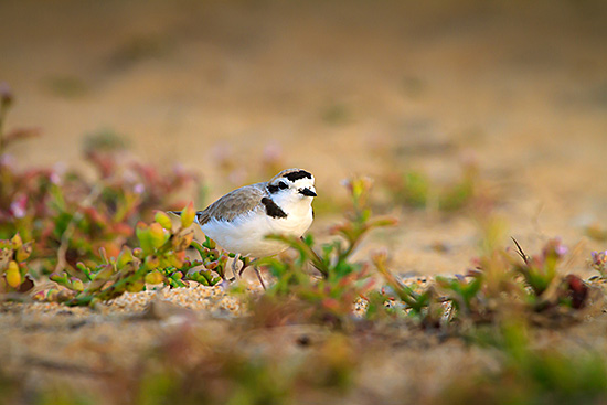 Threatened Western snowy plover in breeding plumage at proposed Project site in Sand City. (Photograph: Steve Zmak)
August 2015
The Dunes Restoration Plan for the Monterey Shores Resort proposed for 39 acres of rare beachfront dune habitat in Sand City has been released and Ventana Chapter has retained experts to submit comments. The developer, Security National Guaranty (SNG) is proposing construction of a 1.3 million square foot mixed-use residential and visitor-serving development in undeveloped dunes seaward of Highway One adjacent to Fort Ord Dunes State Park in Sand City.
These undisturbed beachfront dunes contain several threatened and endangered species and have been monitored for nesting coastal populations of western snowy plover since 1999. Ventana Chapter attorney Larry Silver has retained senior biologist Scott Cashen to provide comments on the western snowy plover. Dr. Cashen (Dr. Cashen letter here) focuses on inadequacies in the Plan which proposes measures that will not offset the Project's contribution to habitat loss. Coastal ecologist Peter Baye's (Dr. Baye letter here) report highlights coastal dune ecology and management with an emphasis on Smith's blue butterfly, Monterey spineflower and western snowy plover.
June 2015
Ventana Chapter retained expert coastal ecologist Peter Baye, Ph.D. to submit comments on the biological resources in the Draft Environmental Impact Report (DEIR) for the proposed horse racing track and housing development on the former Fort Ord military base. The Applicant seeks a project which proposes to construct Monterey Downs, a racetrack and other equestrian use facility, 1280 dwelling units (detached single-family and multi-family), a mix of commercial, office and hotel uses and more.
Dr. Baye comments address 5 deficiencies in the DEIR including: 1. The project description's failure to correctly identify the environmental setting of the project site and vicinity as a stabilized ancient dune system or paleodune. This is a significant omission because of the environmental importance and very limited geographic distribution of this ancient geomorphic feature in California, and its association with relict endemic species. Paleodunes include distinctive variations of the following vegetation types: coastal prairie (grassland), maritime chaparral, seasonal and perennial freshwater marshes, and oak woodlands.
2. The DEIR fails to assess impacts to wetlands habitats and fails to provide minimal survey information regarding the presence, extent, or distribution of wetland habitats. No information is provided regarding the areas surveyed, the dates of surveys, the rainfall year(s), or the qualifications (wetlands expertise) of the observers. 3. Special-status plant species impact criteria are invalid and unsound in terms of biological or regulatory meaning and the DEIR provides inadequate biological analysis of the number, size, viability, and distribution of special-status plant species populations.
Deficiencies 4. and 5. relate to the fact that the project would have significant and unmitigated impacts on California tiger salamander and two important vegetation types, oak woodlands and riparian woodlands. For more information and a full description of these biological concerns see Dr. Baye's letter. (Attached PDF here).
.
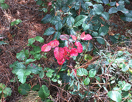 Poison oak conserving energy (Photograph: Mary Pendlay) Poison oak conserving energy (Photograph: Mary Pendlay)
|
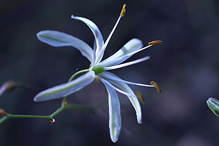 Soap plant in bloom. (Photograph Mary Pendlay) Soap plant in bloom. (Photograph Mary Pendlay)
|
June 2015
By Mary Pendlay
This time of year at Jacks Peak Park reflects the contrast between the north and south-facing slopes. At its peak, the gradual slope of 1,096 feet is easy to traverse, to walk and enjoy the natural plants and wildlife. This year, after many dry seasons, the differences between north and south slopes are dramatic. The poison oak, safely removed from the trail, is very apparent on the northern slope where it's cooler. The red leaves are already appearing because the roots lack moisture and know that it's time to conserve, like a deciduous tree that turns color. To see red leaves so early in the year is lovely, but a sign that the plant is distressed. Not to worry, poison oak is tough, but not tough enough to grow on the southern slopes where it's really warm from the wind currents coming up from Carmel Valley. Far from this heat, the Indian soap plant is ready to bloom, and it is a survivor, with a beautiful flower. This time of year, there are numerous flower stalks blooming in the warm afternoon sun even as the leaves begin to wither. Appearing mostly in shade areas, the pine and oak trees provide enough shade for the soap plant's bulb to reproduce every year. The Rumsien/Ohlone Indians used this plant like the ceanothus flower, as a cleanser. Jacks Peak Park reveals contrasted environments because its Monterey Pine forest is central to our area, which can be dramatic.
 Stunning views along the trail on the San Jose Creek Loop hike in Carmel in May. Stunning views along the trail on the San Jose Creek Loop hike in Carmel in May.
Take
|
|
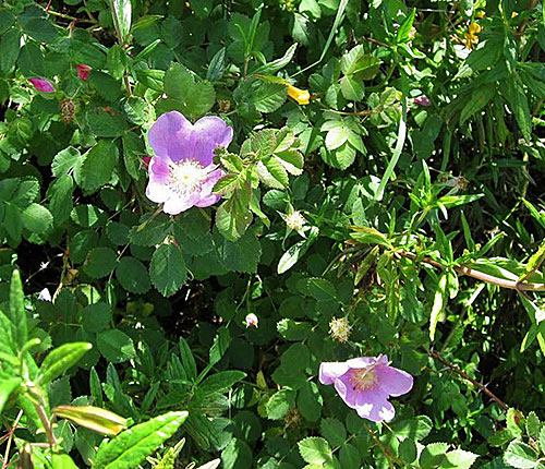 Lovely wild rose near San Jose Creek. Lovely wild rose near San Jose Creek. These are photos taken by leader Burkhard Seidhofff from a new area in the San Jose Creek Loop in Carmel we did in May. Check out the outings schedule with more hikes through June 30. |
|
May 2015
 Western snowy plover nesting at the SNG site in Sand City. (Photograph: Steve Zmak).
Attorney Larry Silver represented Sierra Club Ventana Chapter at the California Coastal Commission (CCC) hearing in Santa Barbara on May 15 regarding the status of ongoing discussions between the developer Security National Guarantee (SNG) and CCC staff. SNG is proposing construction of a 1.3 million square foot mixed-use residential and visitor-serving development in undeveloped dunes seaward of Highway One between Fort Ord Dunes State Park and Monterey Peninsula Regional Park District's Eolian Dune Preserve in Sand City. These undisturbed beachfront dunes contain several threatened and endangered species and have been monitored for nesting coastal populations of western snowy plover since 1999. Attached (here) is a photo showing the locations of 5 nests on the site on May 1 showing no measures in place to protect the nests from trampling and at least three have now been lost.
Still unresolved are about six areas of "Special Conditions" for the Project including lighting, signage, height limits, a resort pathway layout that interferes with snowy plover habitat, perimeter fencing, manipulated dune heights and dune restoration plans, public access and other issues. After nearly an hour of testimony from CCC staff, our attorney, the developer and Commissioners, the Board voted to have staff continue discussions with SNG and bring the matter back to the CCC later this year.
The Chapter also submitted a letter describing legally required conditions for protection of species such as Smith’s blue butterfly and snowy plover. The letter included an addendum with expert findings from environmental biologist Scott Cashen describing a monitoring and maintenance plan, a reporting and contingency program and other federal requirements for protection of western snowy plover. (PDF of the letter is attached).
May 2015
Seven environmental groups including Sierra Club filed a lawsuit on May 14 in Washington DC challenging safety rules issued this month for trains carrying oil, arguing that the regulations are too weak to protect the public.
The groups said the new rules would allow the industry to continue to use "unsafe tank cars" for up to 10 years. They also said the rules failed to set adequate speed limits for oil trains.
The United States and Canada issued the safety standards in response to a string of explosive accidents that have accompanied a surge in crude-by-rail shipments. Because of a 40-fold increase in crude-by-rail transport since 2008, derailments and spills have been on a steep rise. In 2013 more crude oil was spilled from trains than in the previous four decades combined, and in 2014 there were more oil train accidents than in any other year on record.
In their filing, the groups asked the United States Court of Appeals for the Ninth Circuit to force the Transportation Department to reconsider the "unduly long phaseout period" for these tank cars, as well as the speed limit and public notification requirements in the rule.
Oil trains are a hot issue locally as there has been a state-wide firestorm of protest over Phillips 66’s proposal to transport Canadian crude oil from Richmond through several counties including Monterey County to an oil refinery in San Luis Obispo.
May 2015
On May 7, Earthjustice, on behalf of Sierra Club and the Center for Biological Diversity, filed a lawsuit in Alameda County Superior Court to halt the oil industry from injecting fracking waste water into protected aquifers.
California Department of Conservation has allowed construction of at least 2,500 wells that inject fluids which include oil well waste directly into protected aquifers. Half of these permits were issued in the last four years. These permits have been issued despite growing warnings from the U.S. Environmental Protection Agency (USEPA) since 2011 that state regulators were out of compliance with federal laws meant to protect underground drinking-water stores from oilfield contamination.
The response from the Brown Administration's Division of Oil, Gas and Geothermal Resources (DOGGR) has been to establish "emergency" regulations that allow the injection wells to continue until at least 2017.
Oil wastewater in California typically contains high levels of cancer-causing benzene, according to testing done by DOGGR and oil companies. Wastewater can also include fracking fluid, which often contains chemicals that are linked to serious human health problems, including cancer and birth defects.
"Existing state and federal laws rightly recognize that groundwater is a precious commodity, and for decades, the law has protected both the aquifers already in use as well as those that might come into future use," said Nathan Matthews of Sierra Club. "DOGGR's emergency rule turns legal tradition on its head and gives the oil and gas industry free rein to contaminate California's aquifers prior to determining whether the ground water will be needed in the future."
Sierra Club California is the sponsoring chapter for the Club's role in the suit. (Source: Sierra Club California)
 This aerial photo shows the vast oak woodlands that would be wiped out to accommodate this enormous development. Why destroy the natural gateway to the National Monument when so much of the urban area of Fort Ord remains dilapidated and condemned? (Photo and graphics by Steve Zmak) Click for full sized image.
April 2015
The City of Seaside in Monterey County has released the Draft Environmental Impact Report (DEIR) for a proposed horse racing track and housing development on the former Fort Ord military base. Ventana Chapter has retained coastal ecologist Dr. Peter Baye to review biological resources in the document and to prepare comments prior to the deadline of June 19. Sierra Club has been following development at Fort Ord since the 1990's when we sued on deficiencies in the Environmental Impact Report and reached a settlement agreement. Since then, we have several times had to retain attorneys to defend our agreement in order to keep environmental controls in place.
The Applicant seeks a project which proposes to construct Monterey Downs, a racetrack and other equestrian use facility, 1280 dwelling units (detached single-family and multi-family), a mix of commercial, office and hotel uses and more. The City of Seaside has circulated a document describing the project as likely to have significant impacts to aesthetics, air quality, loss of coast live oak and landmark coast live oak (some estimate a loss of over 40,000 trees), greenhouse gas emissions, increased traffic and dwindling water supplies. The documents can be viewed on the City website at: http://www.ci.seaside.ca.us/
February 2015
Senate Bill 270, calling for a ban on the use of handled plastic bags in grocery stores, food marts and convenience stores, was signed last September by California Governor Jerry Brown. This ban, long supported by Sierra Club required an eight year effort to get passed and goes into effect this summer for grocery stores and in the summer of 2016 for convenience stores. Its immediate effect will be that soon shoppers will be encouraged even more than before to use re-useable bags. To celebrate the implementation of the bag ban, Ventana Chapter has ordered hundreds of cotton canvas bags to distribute to members and the community to replace plastic bags.
The bill's long-term effect will be reduced trash along roadways and in cities, a drop in plastic pollution in waterways and oceans and one less everyday product that encourages ours to be a throwaway culture.
Sounds great, right? Yes, but unfortunately, there is opposition from the plastic bag industry which raised hundreds of thousands of signatures to seek to overturn the new law through referendum on the 2016 ballot. This petition was pushed by the American Progressive Bag Alliance, a group that's part of the plastics industry trade association called SPI. Both groups are based in Washington, DC. Both groups represent plastic bag manufacturers based outside of California who are apparently offended by Californians' desire to live in a place that is not polluted with plastic bags.
Remember, this bill establishing the plastic bag ban was not created on a whim. It was the result of many years of work and had been preceded by other ban bills that failed. The bill had also been preceded by adoption of local plastic bag bans in more than 100 California cities.
So now we have a situation that we have seen before in California. State lawmakers create policies that protect the environment and have broad support. Then out-of-state special interests move in and try to stop the policies from taking hold.
The plastics makers who want to kill the ban bill have turned in more than the 500,000 signatures required for qualifying on the ballot. The results of the validity of the signatures will be announced in a few weeks. (Source: Sierra Club CA)
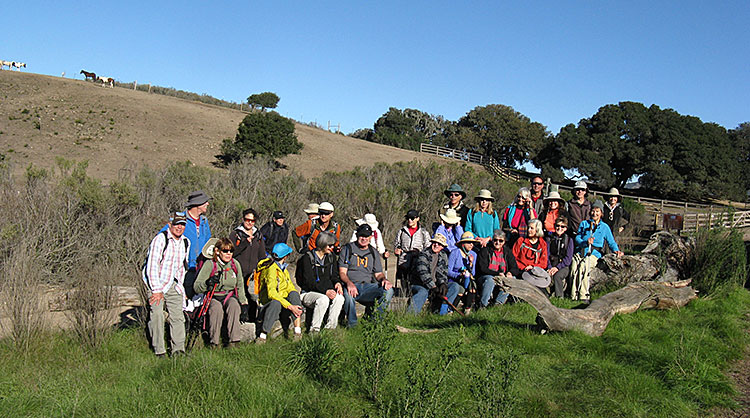 30 hikers joined Chapter Outings leader, Anneliese Suter in this photo from a trek up to Snively's Ridge in Garland Ranch on New Year's Day. Rewards included coffee and cake (Kaffee und Kuchen) with whipped cream at Anneliese's home.
November 2014
The Monterey County Board of Supervisors is scheduled to decide on the future of Ferrini Ranch at the December 2 Board meeting. This project includes new construction of a subdivision of about 870 acres into 185 lots of record for market rate single family homes on Highway 68 near Toro Park in Salinas. Also proposed is future development of winery related uses that would result in the removal of up to 921 protected Oak Trees and a Use Permit for development on slopes exceeding 30 percent.
The Chapter has submitted a letter opposing the project on the grounds that it is too large, would create urban sprawl and thus contribute to greenhouse gas emissions from excess single vehicle use. Traffic studies have shown that the project will exacerbate the current F rating for the highly congested Highway 68 corridor. Furthermore, we believe this project is not needed as there are already 10,000 residential units approved but not yet constructed in the County, it would cause negative impacts to biological resources including species of special concern on site that cannot be mitigated and it would require water from the Salinas Valley Groundwater Basin that has been over drafted for years. (Attached is our letter to the BOS as a PDF).
|
Carmel Valley artist, Paola Berthoin gives a painting demonstration for Chapter members at her studio and garden which has been certified as National Wildlife Federation Certified Habitat. Ms. Berthoin has spent years creating stunning artwork and a book entitled |
 |
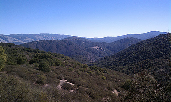
|
Stunning Carmel Valley and Wilderness views from a recent Chapter hike on the Manzanita Trail at Kahn Ranch. Hikers can reserve a free access permit on line at the Monterey Peninsula Regional Park District website: http://www.mprpd.org/index.cfm/ |
January 2014
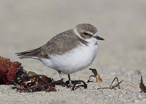 Sierra Club has concerns about the future of this federally-listed Threatened Western snowy plover with planned developments in coastal dunes at Sand City. (Photographer Brian L. Sullivan).
Ventana Chapter's attorney, Larry Silver has filed an appeal with the California Coastal Commission over the approval by the Sand City City Council of the The Collection at Monterey Bay resort planned for 26 acres in the dunes west of Highway 1. As proposed, the 340 unit resort is to be constructed in two phases: the first phase will include 105 time share units and the second phase will include a 235-unit hotel with a restaurant, conference center and wellness spa. There will be over 600 parking spaces.
The appeal says that the project as approved is inconsistent with the City's certified Local Coastal Program (LCP) policies including those related to hazard avoidance, protection of public views and natural resources, public access and adequacy of public services (traffic). The FEIR is inadequate and does not address protection of Seacliff buckwheat or Western snowy plover at the site. The project does not avoid and minimize significant impacts to important public views of the Pacific Ocean and the Monterey Peninsula. And the FEIR does not adequately address traffic access and shoreline hazards at the site.
Furthermore, the development is not sited to ensure safety and dune stability over its economic lifetime as required by the City's LCP. Portions of the project would be threatened by coastal erosion over time and the FEIR does not address this high risk scenario. Also, the FEIR does not discuss the effects on public access of re-routing the Monterey Bay Sanctuary Scenic Trail to accommodate this project.
California Coastal Commission Chair Steven Kinsey and Commissioner Mary Shallenberger have also filed an appeal of the Collection proposed development to the CCC. They argue that "the approved project is inconsistent with provisions of Sand City's certified Local Coastal Program with respect to hazards, natural visual resources, development and public access, and is also inconsistent with the public access and recreation policies of the Coastal Act."
|
Make a contribution to the Sierra Club today - stop fracking in Monterey County! Your local Sierra Club Chapter and Group needs financial support to carry on our fight to protect the spectacular coast, valleys, and mountains. We cannot fight for endangered and at risk wildlife without money. We cannot save precious forests, mountains, watersheds, and open spaces without money. We know that you care about the environment from your membership in the Club. Now we need your help. Much of the work of the Club consists of non-glamorous, roll-up-your-sleeves labor. Volunteers study EIRs and make comments; activists get government staff reports and keep tabs on proposed developments and policy changes; sometimes the Club files suit. Please help us continue to protect and preserve the Central Coast. To make a donation please send a check made out to ‘Sierra Club' to Sierra Club Ventana Chapter, P O Box 5667, Carmel, CA 93921-5667 Contributions to the Sierra Club are not tax deductible. To send tax deductible contributions, which mainly support legal actions when they become necessary, make your check out to ‘Sierra Club Foundation' instead. |
|


 A volunteer with NYC Audubon's Project Safe Flight holds a dead female Common Yellowthroat in front of the Time Warner Center in Manhattan. Photo: Francois Portmannion.
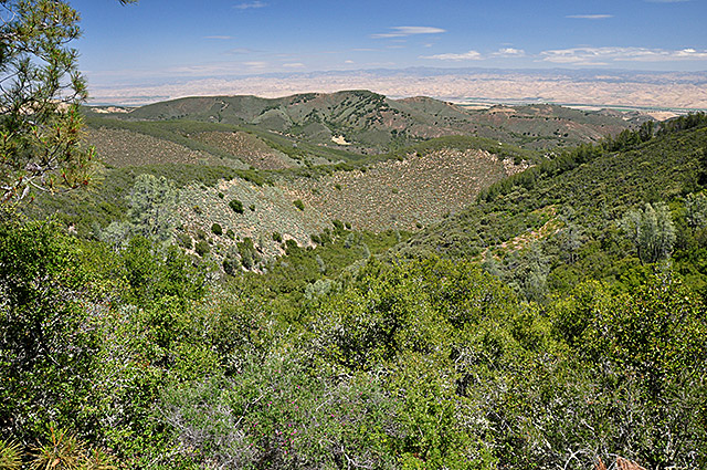 South Monterey County land near Lockwood-San Ardo Road looking northeast towards the Salinas Valley across a BLM Lease parcel proposed for auction.
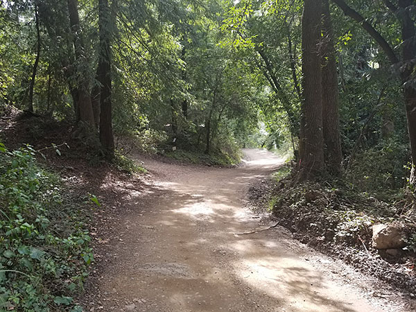 Blaze Engineering has a proposal to set up a construction yard site in this redwood forest and ESHA habitat in Big Sur.
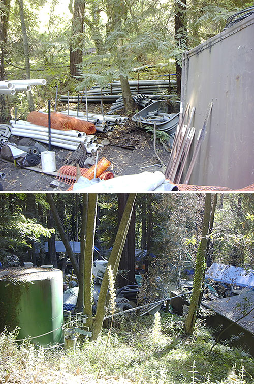 Rare coastal redwood forest habitat in Big Sur found destroyed after Blaze
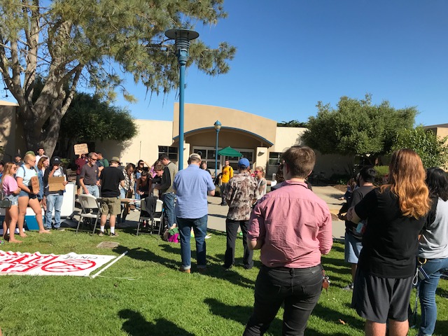

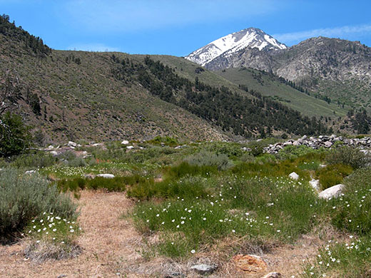 Mt. Mary Austin peaking above the hills from the Oak Creek trailhead.
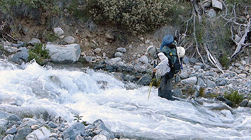 Richard ferrying my pack across Oak Creek..
 Balloons are everywhere in the Sierra.
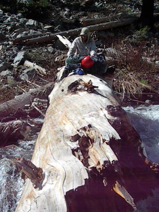

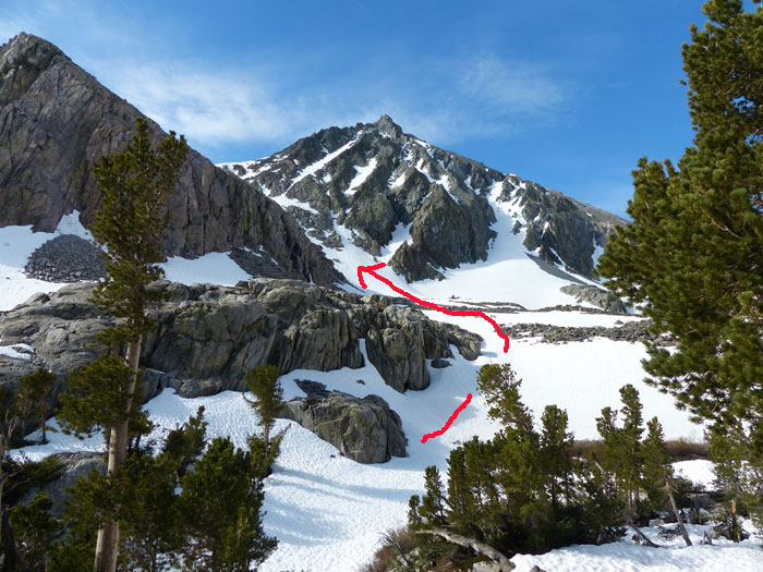
 All dressed up but too tired to climb.
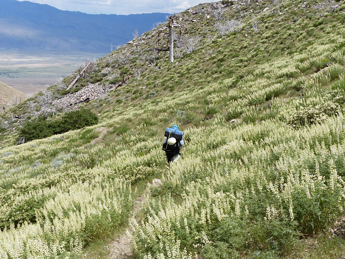

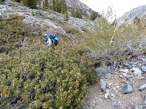 Can you believe it? I'm on the trail.
 Thankfully we found another log.
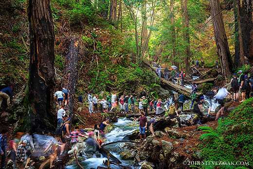
 Sierra Club Ventana Chapter member Steve Zmak and his rooftop solar panels at his home in Marina.
 Debbie finds a balloon in one of the plots.